
Wetlands Watch is recruiting volunteers for the October 17-20 2024 King Tide measuring initiative. People of all ages are encouraged to participate in this once-a-year effort to track the highest tides of 2024 and, by extension, the flooding impact on the environment and communities. Sign up to volunteer. The last training takes place Tuesday, October 15 though instructions and FAQs are available online.
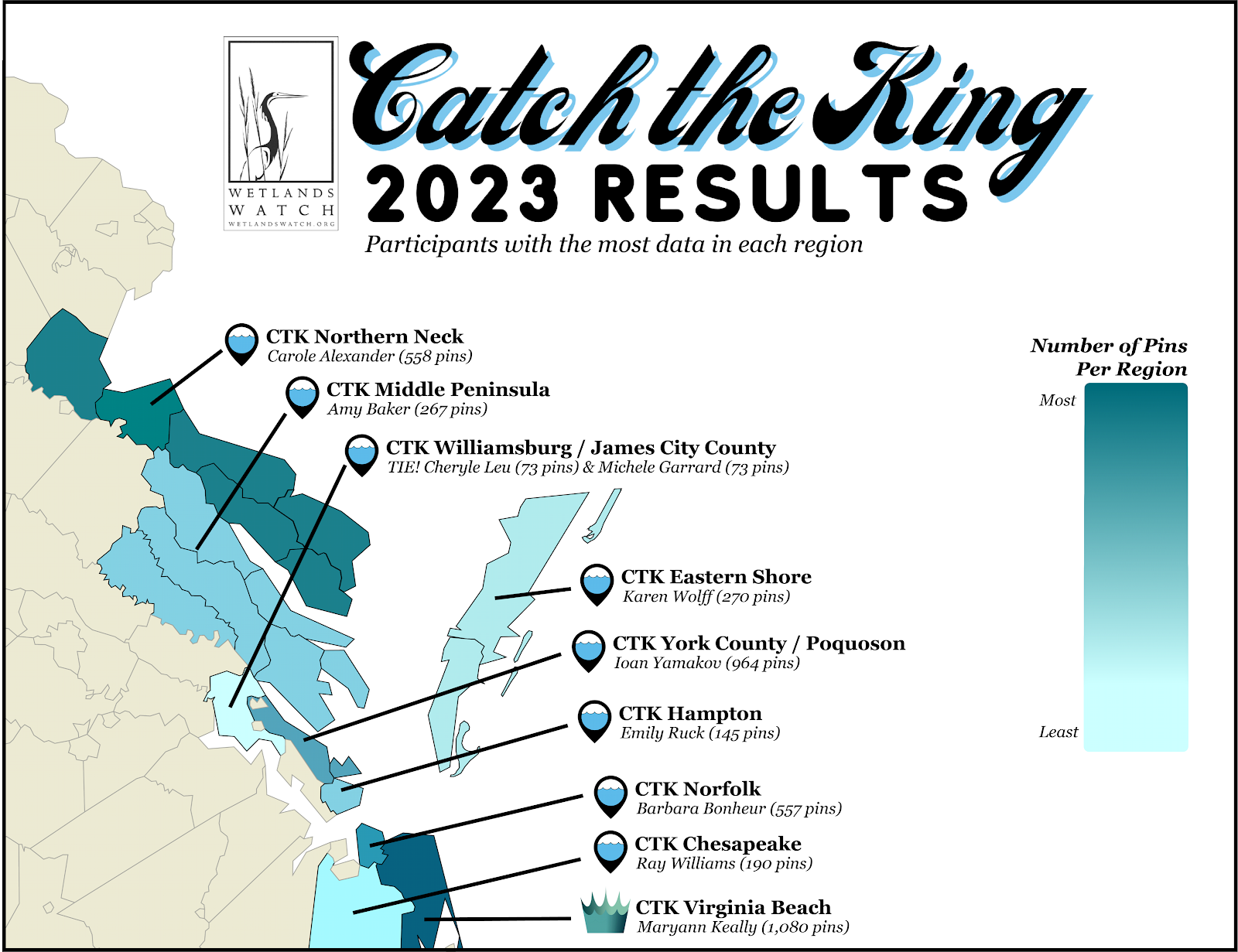
In 2023, volunteers on the Northern Neck placed 558 virtual pins. With hundreds of miles of shore, more locations need to be pinned.
Why volunteer
Catch the King relies on volunteers to track the highest predicted tides of the year in southeast Virginia. The October King Tide happens when the moon, earth, sun, and fall full/new moons are aligned in this part of the state. Volunteer citizen scientists add their data to that King Tide data collected in the past. Scientists and others map the changes in sea level rise and flooding and make planning, zoning, and policy recommendations, implement stop gaps for immediate flooding mitigation, and the like.
As the videos below show, citizen scientists are people of all ages who volunteer to identify King Tide flooding. Volunteers mention the personal benefits in addition to the benefits to the commons: The data helps the government take action to improve stormwater runoff systems, protect communities from sea level rise and flooding, and increase/improve resilience. From a volunteer perspective, participating makes people feel like they are making a difference in and for their community.
Practically speaking, getting more mapping done on the NNK would benefit us all. While there are volunteers on the Northern Neck, the majority are in the Hampton Roads area, which makes total sense, but sea level rise and flooding (think Lewisetta and Lottsburg) will happen more as time goes on and flooding and subsidance increase.